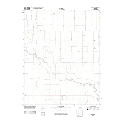
2010 Map of Hough
USGS Topo · Published 2010About this map
Hough serves as the primary focal point of this 2010 topographic survey in the Oklahoma Panhandle, situated in a landscape defined by expansive section lines and a sparse network of county roads. The terrain is deeply incised by the meanders of Goff Creek and Little Goff Creek, which snake across the southern half of the quadrangle, while Cow Creek drains the northwest corner. This drainage pattern reveals the natural watercourses that break up the otherwise rigid grid of agricultural land. Genealogists and local historians will find significant interest in the Lee Cemetery and Trinity Lutheran Cemetery, both located along the eastern edge of the map. These sites, along with the alignment of major thoroughfares like Us 64 and Us 412, provide essential markers for tracing family heritage and 21st-century settlement patterns in this part of Texas County.
Find a feature on this map
34 named features on this map. Tap any name to fly to it.
Don’t see what you’re looking for? This feature index may not catch every label — zoom into the map to look around manually.
Map Details
Editions of this 2010 Hough Map
This is the sole edition of this map. No revisions or reprints were ever made.
Other maps of this area

1954 · Perryton
USGS Topo · 1:250,000

1958 · Perryton
USGS Topo · 1:250,000

1967 · Straight
USGS Topo · 1:24,000

1967 · Straight SW
USGS Topo · 1:24,000

1968 · Guymon
USGS Topo · 1:24,000

1973 · Goodwell NW
USGS Topo · 1:24,000

1973 · Hough SW
USGS Topo · 1:24,000

1973 · Hough NE
USGS Topo · 1:24,000

1973 · Goodwell NE
USGS Topo · 1:24,000

1973 · Hough NW
USGS Topo · 1:24,000