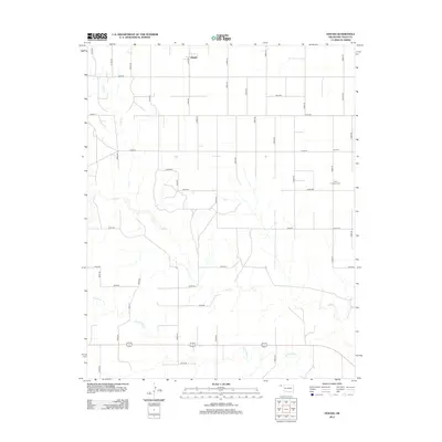
2012 Map of Hough
USGS Topo · Published 2012About this map
Hough stands as a focal point in this portion of the Oklahoma Panhandle, situated within a landscape defined by an orderly grid of section roads and the intermittent drainage of the High Plains. The terrain is marked by the winding courses of Cow Cr., Goff Cr., and Little Goff Cr., which break the geometric precision of the agricultural layout. These ephemeral watercourses suggest the environmental challenges of the region, where water management and road placement are dictated by the subtle topography of the plains. Local history and genealogy interests are centered on two primary sites in the eastern half of the quadrangle: Lee Cem and Trinity Lutheran Cem. The presence of these burial grounds, alongside the network of county routes like Co Hwy-23 and Co Hwy-7, provides a record of rural community organization in Texas County during the early 21st century.
Find a feature on this map
37 named features on this map. Tap any name to fly to it.
Don’t see what you’re looking for? This feature index may not catch every label — zoom into the map to look around manually.
Map Details
Editions of this 2012 Hough Map
This is the sole edition of this map. No revisions or reprints were ever made.
Other maps of this area

1954 · Perryton
USGS Topo · 1:250,000

1958 · Perryton
USGS Topo · 1:250,000

1967 · Straight
USGS Topo · 1:24,000

1967 · Straight SW
USGS Topo · 1:24,000

1968 · Guymon
USGS Topo · 1:24,000

1973 · Goodwell NW
USGS Topo · 1:24,000

1973 · Hough SW
USGS Topo · 1:24,000

1973 · Hough NE
USGS Topo · 1:24,000

1973 · Goodwell NE
USGS Topo · 1:24,000

1973 · Hough NW
USGS Topo · 1:24,000