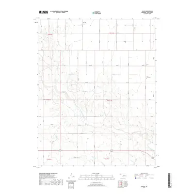
2018 Map of Hough
USGS Topo · Published 2018About this map
The high plains of the Oklahoma Panhandle define this 2018 survey, centered on the settlement of Hough. The landscape is dominated by the drainage systems of Goff Creek and its tributary Little Goff Cr, which cut through the level terrain as they flow toward the southeast. These watercourses provide some of the few topographical variations in an area otherwise marked by a rigid grid of agricultural roads, such as RD J and e0120 RD.
Find a feature on this map
29 named features on this map. Tap any name to fly to it.
Don’t see what you’re looking for? This feature index may not catch every label — zoom into the map to look around manually.
Map Details
Editions of this 2018 Hough Map
This is the sole edition of this map. No revisions or reprints were ever made.
Other maps of this area

1954 · Perryton
USGS Topo · 1:250,000

1958 · Perryton
USGS Topo · 1:250,000

1967 · Straight
USGS Topo · 1:24,000

1967 · Straight SW
USGS Topo · 1:24,000

1968 · Guymon
USGS Topo · 1:24,000

1973 · Goodwell NW
USGS Topo · 1:24,000

1973 · Hough SW
USGS Topo · 1:24,000

1973 · Hough NE
USGS Topo · 1:24,000

1973 · Goodwell NE
USGS Topo · 1:24,000

1973 · Hough NW
USGS Topo · 1:24,000