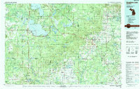
1983 Map of Houghton Lake
USGS Topo · Published 1984About this map
Houghton Lake and Higgins Lake dominate this northern Michigan landscape, centers of a region defined by extensive public lands and water resources in the early 1980s. The map illustrates the concentration of development in lakeside communities like Houghton Lake Heights and Prudenville, contrasted with the vast undeveloped tracts of the Au Sable State Forest and Pere Marquette State Forest. Industrial and transportation patterns are visible through the Detroit and Mackinac rail line and an old RR grade cutting through the forest near St Helen. Conservation efforts are prominent, with the Houghton Lake Wildlife Research Area and the Rifle River State Recreation Area preserving natural habitats across multiple county lines. Local landmarks such as Roscommon County Airfield and the swampy reaches of Haymarsh Swamp provide fine-scale detail for those researching the rural geography of the era.
Find a feature on this map
98 named features on this map. Tap any name to fly to it.
Don’t see what you’re looking for? This feature index may not catch every label — zoom into the map to look around manually.
Map Details
Editions of this 1983 Houghton Lake Map
This is the sole edition of this map. No revisions or reprints were ever made.
Other maps of this area

1949 · Fletcher
USGS Topo · 1:62,500

1949 · Grayling
USGS Topo · 1:62,500

1950 · Cote Dame Marie
USGS Topo · 1:24,000

1950 · Fletcher
USGS Topo · 1:24,000

1950 · Roscommon North
USGS Topo · 1:24,000

1951 · Roscommon North
USGS Topo · 1:24,000

1951 · Pere Cheney
USGS Topo · 1:24,000

1954 · Traverse City
USGS Topo · 1:250,000

1954 · Midland
USGS Topo · 1:250,000

1954 · Flint
USGS Topo · 1:250,000