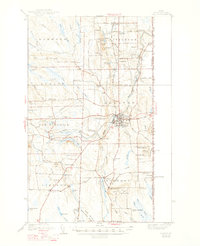
1938 Map of Houlton
USGS Topo · Published 1947About this map
The Meduxnekeag River and its south branch anchor this portrait of Aroostook County, where the international border with New Brunswick, Canada, defines the eastern edge of the landscape. As a vital northern hub, Houlton is shown with its dense street grid and significant infrastructure, including the Transoceanic Telephone Receiving Station and a large Fish Hatchery. The map captures a high density of rural schoolhouses and neighborhood markers such as Starkey Corners, Porter Settlement, and Jackins Settlement, which illustrate the dispersed agricultural settlement patterns of the 1930s.
Find a feature on this map
85 named features on this map. Tap any name to fly to it.
Don’t see what you’re looking for? This feature index may not catch every label — zoom into the map to look around manually.
Map Details
Editions of this 1938 Houlton Map
3 editions found
Other maps of this area

1934 · Bridgewater
USGS Topo · 1:48,000

1935 · Howe Brook
USGS Topo · 1:48,000

1937 · Smyrna Mills
USGS Topo · 1:62,500

1938 · Bridgewater
USGS Topo · 1:62,500

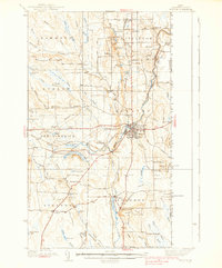
1938 · Houlton
USGS Topo · 1:62,500

1939 · Howe Brook
USGS Topo · 1:62,500

1940 · Amity
USGS Topo · 1:62,500

1941 · Amity
USGS Topo · 1:62,500

1941 · Mattawamkeag Lake
USGS Topo · 1:62,500

1943 · Amity
USGS Topo · 1:62,500