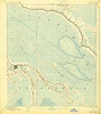
1892 Map of Houma
USGS Topo · Published 1925About this map
Houma sits at the nexus of several vital waterways in the late nineteenth century, reflecting its role as a regional hub for the bayou-based economy. The town is situated where Bayou Black meets the Bayou Terrebonne, surrounded by a landscape of sprawling wetlands and distinct ridge-top settlements. Along the Bayou Lafourche, the map documents the linear pattern of plantation properties and settlements including Raceland and Lockport, connected by the Southern Pacific R. R. and the Company Canal. This era represents a transition from purely water-borne transport to the introduction of rail, yet the geography remains dominated by large bodies like Field Lake and Lake Long. The survey provides a clear look at the intricate network of natural drainage, including Bayou Blue and Bayou de Large, that defined the early development of Terrebonne and Lafourche parishes.
Find a feature on this map
16 named features on this map. Tap any name to fly to it.
Don’t see what you’re looking for? This feature index may not catch every label — zoom into the map to look around manually.
Map Details
Editions of this 1892 Houma Map
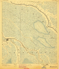
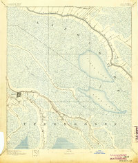
4 editions found
Other maps of this area

1891 · Hahnville
USGS Topo · 1:62,500

1892 · Lac Des Allemands
USGS Topo · 1:62,500

1892 · Gibson
USGS Topo · 1:62,500

1892 · Cut-Off
USGS Topo · 1:62,500

1892 · Houma
USGS Topo · 1:62,500

1892 · Thibodaux
USGS Topo · 1:62,500

1894 · Bayou De Large
USGS Topo · 1:62,500

1894 · Lake Felicity
USGS Topo · 1:62,500

1894 · Dulac
USGS Topo · 1:62,500

1897 · Gibson
USGS Topo · 1:62,500