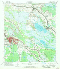
1963 Map of Houma
USGS Topo · Published 1968About this map
Houma serves as the focal point of this coastal Louisiana landscape, where the Gulf Intracoastal Waterway and the Southern Pacific railroad intersect a complex web of natural bayous. The 1960s economy is visibly tied to the land and water, evidenced by the Hollywood Gas Field and numerous drill holes scattered across the wetlands. This survey captures a transitional period of infrastructure, showing the Houma-Terrebonne Airport and various education sites like the Southdown High Sch and Raceland High Sch. Significant family and local history is preserved in the locations of the Aragon Plantation and numerous burial grounds, including the Myrtle Grove Cem and Crozier Cem. The map illustrates how settlements like Lockport, Raceland, and Bourg have developed strictly along the high ground of the bayou ridges, separated by expanses of open water such as Lake Fields.
Find a feature on this map
110 named features on this map. Tap any name to fly to it.
Don’t see what you’re looking for? This feature index may not catch every label — zoom into the map to look around manually.
Map Details
Editions of this 1963 Houma Map
4 editions found
Other maps of this area

1891 · Hahnville
USGS Topo · 1:62,500

1892 · Lac Des Allemands
USGS Topo · 1:62,500

1892 · Gibson
USGS Topo · 1:62,500

1892 · Cut-Off
USGS Topo · 1:62,500

1892 · Houma
USGS Topo · 1:62,500

1892 · Thibodaux
USGS Topo · 1:62,500

1894 · Bayou De Large
USGS Topo · 1:62,500

1894 · Lake Felicity
USGS Topo · 1:62,500

1894 · Dulac
USGS Topo · 1:62,500

1897 · Gibson
USGS Topo · 1:62,500