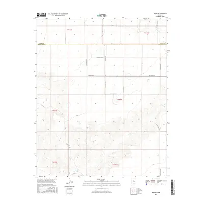
2017 Map of House SE
USGS Topo · Published 2017About this map
The high plains of eastern New Mexico are defined by the winding course of Alamosa Cr and the geometric grid of the Public Land Survey System as it existed in 2017. This quadrangle captures the rural borderlands where the Quay Co Roosevelt Co line divides the landscape, primarily consisting of large agricultural sections and ranch access roads. The terrain is characterized by subtle elevation changes that direct the intermittent flow of the creek toward the southeast. Local transportation is managed through a network of numbered ranch roads, including New Mexico 89 and N Roosevelt Road 22, while named paths like Hill Ranch Rd and Franklin Rd indicate long-standing family landholdings and property boundaries. The map provides a clear view of the sparse but orderly development of the Llano Estacado region, where water drainage and section lines dictate the placement of every homestead and transit route.
Find a feature on this map
26 named features on this map. Tap any name to fly to it.
Don’t see what you’re looking for? This feature index may not catch every label — zoom into the map to look around manually.
Map Details
Editions of this 2017 House SE Map
This is the sole edition of this map. No revisions or reprints were ever made.
Other maps of this area

1954 · Clovis
USGS Topo · 1:250,000

1957 · Melrose
USGS Topo · 1:62,500

1958 · Clovis
USGS Topo · 1:250,000

1973 · Tolar
USGS Topo · 1:24,000

1973 · Weber City
USGS Topo · 1:24,000

1973 · Krider
USGS Topo · 1:24,000

1973 · House
USGS Topo · 1:24,000

1973 · Melrose West
USGS Topo · 1:24,000
1973 · Peach Canyon
USGS Topo · 1:24,000

1973 · Mc Alister
USGS Topo · 1:24,000