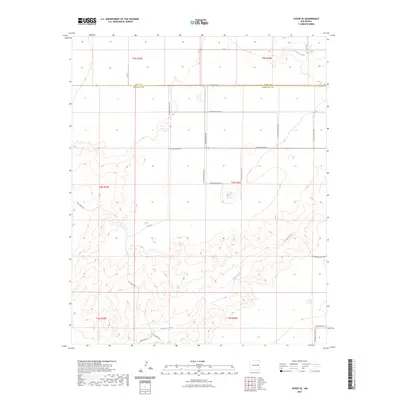
2023 Map of House SE
USGS Topo · Published 2023About this map
Alamosa Creek meanders through this high-plains landscape, cutting through the boundary between Quay Co and Roosevelt Co in eastern New Mexico. The terrain is defined by a grid-like network of rural transit, where state routes like New Mexico 89 intersect with a detailed system of county roads such as Quay-Road-24 and N Roosevelt Road 23. This 2023 survey illustrates a classic Western land pattern, where vast townships and ranges are partitioned by family-named tracks like Hill Ranch Rd and Franklin Rd. The topography reveals the natural drainage of the Llano Estacado, showing how local landmarks and ranch access roads conform to the subtle draws and rises of the plains. For genealogists and local historians, these specific road designations provide the necessary coordinates to locate rural homesteads and legacy agricultural properties within the townships.
Find a feature on this map
27 named features on this map. Tap any name to fly to it.
Don’t see what you’re looking for? This feature index may not catch every label — zoom into the map to look around manually.
Map Details
Editions of this 2023 House SE Map
This is the sole edition of this map. No revisions or reprints were ever made.
Other maps of this area

1954 · Clovis
USGS Topo · 1:250,000

1957 · Melrose
USGS Topo · 1:62,500

1958 · Clovis
USGS Topo · 1:250,000

1973 · Tolar
USGS Topo · 1:24,000

1973 · Weber City
USGS Topo · 1:24,000

1973 · Krider
USGS Topo · 1:24,000

1973 · House
USGS Topo · 1:24,000

1973 · Melrose West
USGS Topo · 1:24,000
1973 · Peach Canyon
USGS Topo · 1:24,000

1973 · Mc Alister
USGS Topo · 1:24,000