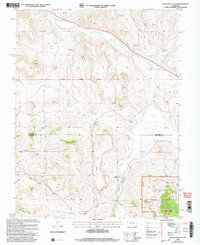
2001 Map of Houston Gulch
USGS Topo · Published 2004About this map
Parlin Flats and the winding course of Tomichi Creek dominate the northern landscape of this Gunnison County study, updated at the start of the 21st century. The terrain transitions from these broad alluvial flats into the complex drainage systems of Houston Gulch and Snyder Gulch. High-altitude ranching and mining history are evident through features like the Green Mesa Ranch and the Alaska Mine, while the southern reaches of the map climb into the timbered slopes of the Gunnison National Forest. A notable concentration of named water sources, including Prospector Spring and Valdez Spring, highlights the importance of water rights in this arid environment, further emphasized by the presence of the Arch Irrigation Ditch. The map also traces the Gunnison and Saguache county line as it traverses the high ridges near Lions Head.
Find a feature on this map
26 named features on this map. Tap any name to fly to it.
Don’t see what you’re looking for? This feature index may not catch every label — zoom into the map to look around manually.
Map Details
Editions of this 2001 Houston Gulch Map
This is the sole edition of this map. No revisions or reprints were ever made.
Other maps of this area

1941 · Pitkin
USGS Topo · 1:62,500

1945 · Pitkin
USGS Topo · 1:62,500

1956 · Montrose
USGS Topo · 1:250,000

1959 · Montrose
USGS Topo · 1:250,000

1960 · Montrose
USGS Topo · 1:250,000

1962 · Doyleville
USGS Topo · 1:24,000

1962 · West Baldy
USGS Topo · 1:24,000

1962 · Iris
USGS Topo · 1:24,000

1962 · Houston Gulch
USGS Topo · 1:24,000

1962 · Razor Creek Dome
USGS Topo · 1:24,000