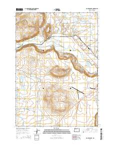
2014 Map of Houston Lake
USGS Topo · Published 2014About this map
Prineville anchors the eastern edge of this Central Oregon landscape, where the high desert terrain meets the fertile Prineville Valley. The agricultural character of the region is defined by a complex network of water management features, including the Peoples Irrigation Company Ditch, the Ochoco Distribution Canal, and several natural drainage ways like McAllister Slough. The Crooked River winds through the center of the quadrangle, flanked by prominent volcanic features such as Round Butte, Myers Butte, and Grass Butte. West of the city, the Prineville Airport sits on the plateau above the river valley. The map also captures the seasonal water bodies of Houston Lake and Little Houston Lake, illustrating the unique hydrology of Crook County's basin-and-range topography.
Find a feature on this map
72 named features on this map. Tap any name to fly to it.
Don’t see what you’re looking for? This feature index may not catch every label — zoom into the map to look around manually.
Map Details
Editions of this 2014 Houston Lake Map
This is the sole edition of this map. No revisions or reprints were ever made.
Other maps of this area

1926 · Bend
USGS Topo · 1:125,000

1929 · Bend
USGS Topo · 1:125,000

1955 · Bend
USGS Topo · 1:250,000

1957 · Bend
USGS Topo · 1:250,000

1958 · Bend
USGS Topo · 1:250,000

1962 · Oneil
USGS Topo · 1:24,000

1962 · Huston Lake
USGS Topo · 1:24,000

1962 · Prineville
USGS Topo · 1:24,000

1962 · Powell Buttes
USGS Topo · 1:62,500
1962 · Powell Butte
USGS Topo · 1:24,000