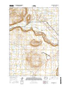
2017 Map of Houston Lake
USGS Topo · Published 2017About this map
Prineville Valley centers this 2017 survey, revealing a landscape defined by the management of water for agriculture and transportation. The Crooked River snakes through the center of the sheet, supported by a network of man-made waterways including the Peoples Irrigation Company Ditch and the Ochoco Distribution Canal. These features, alongside the Elliott Slough, illustrate the complex irrigation infrastructure required to sustain the valley's farms and ranches. To the west, Houston Lake and Little Houston Lake sit near the valley floor, while prominent elevations like Round Butte and Grass Butte provide distinct landmarks above the alluvial plains. The presence of the Prineville Airport in the southeast quadrant reflects the area's modern logistical development, connected by a grid of rural roads that follow section lines and topographic contours.
Find a feature on this map
64 named features on this map. Tap any name to fly to it.
Don’t see what you’re looking for? This feature index may not catch every label — zoom into the map to look around manually.
Map Details
Editions of this 2017 Houston Lake Map
This is the sole edition of this map. No revisions or reprints were ever made.
Other maps of this area

1926 · Bend
USGS Topo · 1:125,000

1929 · Bend
USGS Topo · 1:125,000

1955 · Bend
USGS Topo · 1:250,000

1957 · Bend
USGS Topo · 1:250,000

1958 · Bend
USGS Topo · 1:250,000

1962 · Oneil
USGS Topo · 1:24,000

1962 · Huston Lake
USGS Topo · 1:24,000

1962 · Prineville
USGS Topo · 1:24,000

1962 · Powell Buttes
USGS Topo · 1:62,500
1962 · Powell Butte
USGS Topo · 1:24,000