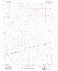
1978 Map of Houston Lakes
USGS Topo · Published 1985About this map
Missouri Pacific railroad tracks cut a diagonal path across the southeastern plains of Colorado in this 1970s survey, marking a vital transit corridor through the high prairie. The small settlement of Heath serves as a focal point along the rail line, representing the sparse but structured network of early rural communities in the region. The landscape is defined by intermittent water sources and drainage patterns, including the prominent Sand Arroyo and the scattered Houston Lakes to the northwest. This map highlights the complex intersection of county boundaries where Kiowa, Otero, and Bent counties meet, a detail of significant value for those tracing regional property records or local administrative history. The numerous scattered Well sites and benchmark markers like BM 4365 indicate the importance of water management and precise surveying in this semi-arid agricultural environment.
Find a feature on this map
13 named features on this map. Tap any name to fly to it.
Don’t see what you’re looking for? This feature index may not catch every label — zoom into the map to look around manually.
Map Details
Editions of this 1978 Houston Lakes Map
2 editions found
Other maps of this area

1891 · Catlin
USGS Topo · 1:125,000

1891 · Las Animas
USGS Topo · 1:125,000

1893 · Las Animas
USGS Topo · 1:125,000

1893 · Catlin
USGS Topo · 1:125,000

1954 · Meredith Hill
USGS Topo · 1:24,000

1954 · Lamar
USGS Topo · 1:250,000

1955 · Mc Intosh Ranch
USGS Topo · 1:24,000
1955 · Lewis Ranch
USGS Topo · 1:24,000

1958 · Lamar
USGS Topo · 1:250,000

1974 · Arlington NE
USGS Topo · 1:24,000