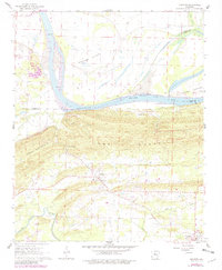
1961 Map of Houston
USGS Topo · Published 1982About this map
The Arkansas River and Fourche La Fave River define this portion of Perry County, creating a landscape of fertile alluvial plains and prominent ridges. Between these river systems, Perry Mountain and Toms Mountain rise sharply, separated by the notable passage at Copperas Gap. This area is shaped by its water-bound geography, featuring the Morrilton Cutoff and expansive lowlands like Sandtown Bottoms and Portland Bottoms. The settlement of Houston serves as a central hub, while the Little Rock and Western railroad corridor provides a vital transportation link across the terrain. Genealogists will find several family-named burial sites across the township, including Leach Cem, Bland Cem, and May Cem, which are scattered among the ridges and valley floors.
Find a feature on this map
28 named features on this map. Tap any name to fly to it.
Don’t see what you’re looking for? This feature index may not catch every label — zoom into the map to look around manually.
Map Details
Editions of this 1961 Houston Map
3 editions found

Other maps of this area

1889 · Morrilton No. 3
USGS Topo · 1:62,500

1890 · Benton
USGS Topo · 1:125,000

1892 · Morrillton
USGS Topo · 1:125,000

1894 · Morrillton
USGS Topo · 1:125,000

1894 · Benton
USGS Topo · 1:125,000

1955 · Little Rock
USGS Topo · 1:250,000

1956 · Little Rock
USGS Topo · 1:250,000

1956 · Russellville
USGS Topo · 1:250,000

1960 · Little Rock
USGS Topo · 1:250,000

1961 · Menifee
USGS Topo · 1:24,000