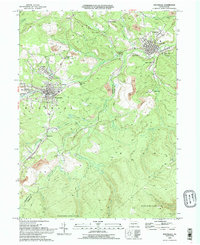
1993 Map of Houtzdale
USGS Topo · Published 1994About this map
Houtzdale and Osceola Mills anchor this early 1990s survey of the Moshannon Creek coal region, where the landscape is defined by extensive industrial excavation. The map reveals the heavy presence of a Strip Mine economy that has reshaped the terrain across Decatur and Woodward townships. Scattered between these excavations are small settlements like Earnestville, New Town, and Spike Island, alongside community fixtures such as the Moshannon Valley Academy and Coal Run Ch.
Find a feature on this map
53 named features on this map. Tap any name to fly to it.
Don’t see what you’re looking for? This feature index may not catch every label — zoom into the map to look around manually.
Map Details
Editions of this 1993 Houtzdale Map
2 editions found
Other maps of this area

1903 · Houtzdale
USGS Topo · 1:62,500

1905 · Houtzdale
USGS Topo · 1:62,500

1920 · Altoona
USGS Topo · 1:62,500

1922 · Philipsburg
USGS Topo · 1:62,500

1922 · Altoona
USGS Topo · 1:62,500

1923 · Tyrone
USGS Topo · 1:62,500

1929 · Tyrone
USGS Topo · 1:48,000

1933 · Tyrone
USGS Topo · 1:62,500

1939 · Philipsburg
USGS Topo · 1:62,500

1944 · Houtzdale
USGS Topo · 1:24,000