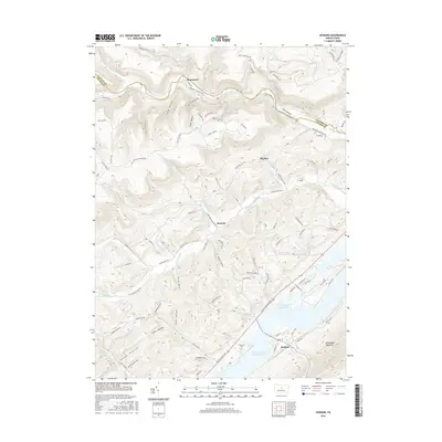
2016 Map of Howard
USGS Topo · Published 2016About this map
Howard sits along the southern edge of this landscape, situated near the shores of Foster Joseph Sayers Lake. The terrain is defined by the sharp rise of Bald Eagle Mountain and the deep incisions of the Allegheny Front, where numerous runs and creeks have carved a complex network of hollows. Smaller settlements like Romola and Monument are tucked into these valleys, connected by roads such as the Monument Orviston Rd. The map reveals a land structured by its water and topography, from the broad expanse of the lake to narrow drainage points like Betz Hollow and Canoe Hollow. Local history is anchored by sites such as Schencks Cem, while the northern reaches transitions into the protected highlands of the Alpine Wilderness Rd. This survey documents a rural Pennsylvania landscape where traditional valley settlements coexist with significant water management infrastructure and expansive state forest lands.
Find a feature on this map
97 named features on this map. Tap any name to fly to it.
Don’t see what you’re looking for? This feature index may not catch every label — zoom into the map to look around manually.
Map Details
Editions of this 2016 Howard Map
This is the sole edition of this map. No revisions or reprints were ever made.
Other maps of this area

1908 · Bellefonte
USGS Topo · 1:62,500

1909 · Bellefonte
USGS Topo · 1:62,500

1921 · Howard
USGS Topo · 1:48,000

1923 · Howard
USGS Topo · 1:62,500

1924 · Centre Hall
USGS Topo · 1:62,500

1928 · Snow Shoe
USGS Topo · 1:48,000

1929 · Centre Hall
USGS Topo · 1:62,500

1931 · Show Shoe
USGS Topo · 1:62,500

1943 · Lewistown
USGS Topo · 1:125,000

1950 · Harrisburg
USGS Topo · 1:250,000