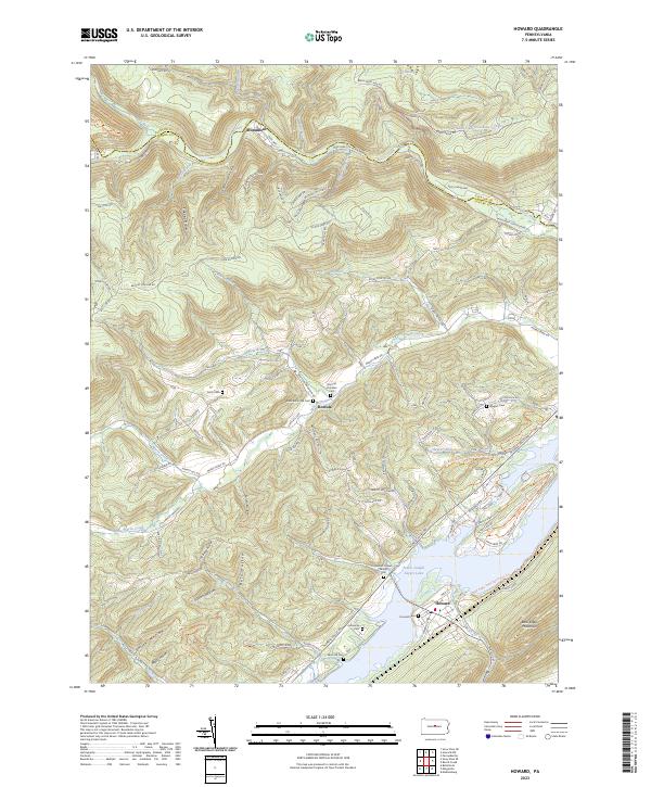
2023 Map of Howard
USGS Topo · Published 2023About this map
Foster Joseph Sayers Lake dominates the southeastern quadrant of this landscape, created by the damming of Marsh Creek and its tributaries. The settlement of Howard sits along the southern shore, while the community of Romola is situated further north along the mountain flanks. The terrain is defined by the steep ridges of Bald Eagle Mountain and Beech Creek Mtn, separated by numerous narrow hollows such as Green Hollow and Slide Hollow. Genealogists will find a wealth of data points here, including family-named landmarks like William Packer Family Cem and Schencks Cem. Public lands are prominent, with Bald Eagle State Park surrounding the reservoir and the Beech Creek Snowmobile Trails Trl winding through the northern forests of Clinton and Centre counties.
Find a feature on this map
122 named features on this map. Tap any name to fly to it.
Don’t see what you’re looking for? This feature index may not catch every label — zoom into the map to look around manually.
Map Details
Editions of this 2023 Howard Map
This is the sole edition of this map. No revisions or reprints were ever made.
Other maps of this area

1908 · Bellefonte
USGS Topo · 1:62,500

1909 · Bellefonte
USGS Topo · 1:62,500

1921 · Howard
USGS Topo · 1:48,000

1923 · Howard
USGS Topo · 1:62,500

1924 · Centre Hall
USGS Topo · 1:62,500

1928 · Snow Shoe
USGS Topo · 1:48,000

1929 · Centre Hall
USGS Topo · 1:62,500

1931 · Show Shoe
USGS Topo · 1:62,500

1943 · Lewistown
USGS Topo · 1:125,000

1950 · Harrisburg
USGS Topo · 1:250,000