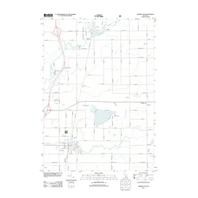
2012 Map of Howard City
USGS Topo · Published 2012About this map
Howard City serves as the primary hub in this portion of Montcalm County, situated where the waters of Tamarack Cr flow through a grid of residential streets including Chestnut St and Walnut St. The surrounding landscape is defined by a dense network of country roads—many named by their distance or family associations—and numerous small water bodies like Henkel Lake and Indian Lake. This 2012 survey illustrates the area's rural character and established community markers, from the Anderson Airport to several burial grounds that reveal the local genealogy, such as Reynolds Cem and Boyd Cem. To the north, the Little Muskegon River meanders past Morley Pond and the Saint Apollonia Cem. The small settlement of Amble remains distinct in the eastern reaches, anchored by Amble Cem and its connection to the surrounding agricultural grid along Amble Rd.
Find a feature on this map
105 named features on this map. Tap any name to fly to it.
Don’t see what you’re looking for? This feature index may not catch every label — zoom into the map to look around manually.
Map Details
Editions of this 2012 Howard City Map
This is the sole edition of this map. No revisions or reprints were ever made.
Other maps of this area

1954 · Midland
USGS Topo · 1:250,000

1958 · Midland
USGS Topo · 1:250,000

1958 · Sand Lake
USGS Topo · 1:62,500

1958 · Woodville
USGS Topo · 1:62,500

1958 · Big Rapids
USGS Topo · 1:62,500

1959 · Midland
USGS Topo · 1:250,000

1959 · Howard City
USGS Topo · 1:62,500

1966 · Midland
USGS Topo · 1:250,000

1976 · Big Rapids SE
USGS Topo · 1:24,000

1976 · Big Rapids SW
USGS Topo · 1:24,000