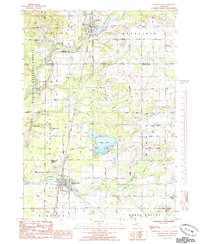
1985 Map of Howard City
USGS Topo · Published 1985About this map
The Little Muskegon River flows through the northern reaches of this mid-1980s survey, anchoring the village of Morley and its namesake Morley Pond. This landscape at the intersection of Mecosta and Montcalm counties reflects a mix of timber history and 20th-century utility, with the Manistee National Forest bordering the western edge and several active Gas Fields scattered throughout Winfield and Reynolds townships.
Find a feature on this map
42 named features on this map. Tap any name to fly to it.
Don’t see what you’re looking for? This feature index may not catch every label — zoom into the map to look around manually.
Map Details
Editions of this 1985 Howard City Map
This is the sole edition of this map. No revisions or reprints were ever made.
Other maps of this area

1954 · Midland
USGS Topo · 1:250,000

1958 · Midland
USGS Topo · 1:250,000

1958 · Sand Lake
USGS Topo · 1:62,500

1958 · Woodville
USGS Topo · 1:62,500

1958 · Big Rapids
USGS Topo · 1:62,500

1959 · Midland
USGS Topo · 1:250,000

1959 · Howard City
USGS Topo · 1:62,500

1966 · Midland
USGS Topo · 1:250,000

1976 · Big Rapids SE
USGS Topo · 1:24,000

1976 · Big Rapids SW
USGS Topo · 1:24,000