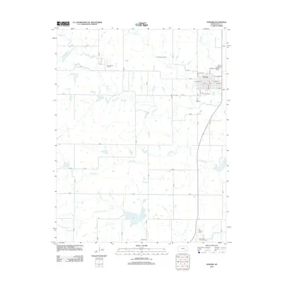
2012 Map of Howard
USGS Topo · Published 2012About this map
Howard serves as the focal point of this Elk County landscape, where the town’s grid meets the wandering path of the Elk River. The area is characterized by its agricultural and ranching infrastructure, evidenced by the Bar P Ranch Airport and the Elk County Fairgrounds. To the south, the Elk County Airport and the Elk County Rodeo Association grounds highlight the community’s regional role. For those tracing family histories, Grace Lawn Cem sits just south of the town center, while Moline Cem is located further south near the banks of N Fork Wildcat Cr. The map also captures local industry through the Dunkleberger Oil Field and the Howard Wastewater Treatment Facility, reflecting the modern utility and energy needs of the plains. Waterways such as Mound Br, Rock Cr, and Bull Cr provide the primary drainage through the rolling sections of the county.
Find a feature on this map
55 named features on this map. Tap any name to fly to it.
Don’t see what you’re looking for? This feature index may not catch every label — zoom into the map to look around manually.
Map Details
Editions of this 2012 Howard Map
This is the sole edition of this map. No revisions or reprints were ever made.
Other maps of this area

1885 · Eureka
USGS Topo · 1:125,000

1885 · Sedan
USGS Topo · 1:125,000

1888 · Eureka
USGS Topo · 1:125,000

1889 · Sedan
USGS Topo · 1:125,000

1894 · Eureka
USGS Topo · 1:125,000

1939 · Severy
USGS Topo · 1:62,500

1941 · Severy
USGS Topo · 1:62,500

1955 · Wichita
USGS Topo · 1:250,000

1958 · Wichita
USGS Topo · 1:250,000

1962 · Moline
USGS Topo · 1:24,000