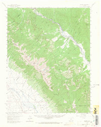
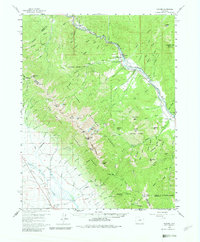
1959 Map of Howard
USGS Topo · Published 1966About this map
The Arkansas River serves as the primary corridor for settlement and industry in this Colorado mountain region during the late 1950s. The Denver and Rio Grande Western Railroad tracks follow the river's path, connecting small communities and industrial sites like the Howard Station and the quarries near Calcite. This era finds the landscape anchored by local institutions such as the Union Ch, Howard Creek Sch, and Stout Creek Sch, reflecting a time when rural education and community centers were geographically decentralized.
Find a feature on this map
83 named features on this map. Tap any name to fly to it.
Don’t see what you’re looking for? This feature index may not catch every label — zoom into the map to look around manually.
Map Details
Editions of this 1959 Howard Map
6 editions found

Other maps of this area

1950 · Valley View Hot Springs
USGS Topo · 1:24,000

1954 · Pueblo
USGS Topo · 1:250,000

1956 · Cameron Mountain
USGS Topo · 1:62,500

1956 · Poncha Springs
USGS Topo · 1:62,500

1956 · Montrose
USGS Topo · 1:250,000

1957 · Pueblo
USGS Topo · 1:250,000

1958 · Pueblo
USGS Topo · 1:250,000

1959 · Montrose
USGS Topo · 1:250,000

1959 · Electric Peak
USGS Topo · 1:62,500

1959 · Bonanza
USGS Topo · 1:62,500