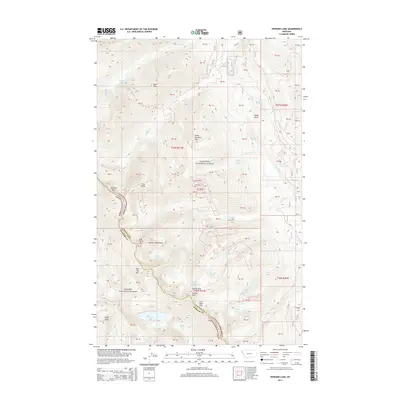
2014 Map of Howard Lake
USGS Topo · Published 2014About this map
The Cabinet Mountains define the high-altitude landscape of this 2014 survey, marking the intersection of the Kootenai National Forest and Kanisku National Forest. The map detail captures a complex drainage system fed by glacial lakes and springs, including Howard Lake, Bramlet Lake, and Ramsey Lake. High peaks such as Great Northern Mtn and Engle Peak rise above the ridgelines that separate Lincoln and Sanders counties. This alpine environment is navigated by historic mountain crossings like Carney Pass and Lost Buck Pass. The presence of named water sources like George Shalo Spring and the intricate network of creek branches—such as W Fisher Cr and Miller Cr—highlights the watershed's importance to the regional geography at the time of this survey.
Find a feature on this map
40 named features on this map. Tap any name to fly to it.
Don’t see what you’re looking for? This feature index may not catch every label — zoom into the map to look around manually.
Map Details
Editions of this 2014 Howard Lake Map
This is the sole edition of this map. No revisions or reprints were ever made.
Other maps of this area

1920 · Libby
USGS Topo · 1:125,000

1920 · Jennings
USGS Topo · 1:125,000

1930 · Libby
USGS Topo · 1:125,000

1932 · Libby
USGS Topo · 1:125,000

1932 · Trout Creek
USGS Topo · 1:125,000

1935 · Thompson Lakes
USGS Topo · 1:96,000

1935 · Trout Creek
USGS Topo · 1:125,000

1936 · Trout Creek
USGS Topo · 1:125,000

1937 · Thompson Falls
USGS Topo · 1:125,000

1942 · Thompson Lakes
USGS Topo · 1:125,000