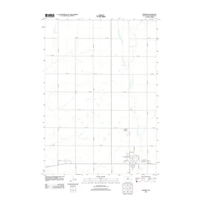
2012 Map of Howard
USGS Topo · Published 2012About this map
The W Fork Vermillion River meanders across this eastern South Dakota prairie, framing the development of Howard and its surrounding agricultural grid. This survey captures the layout of the town in the early 21st century, centered on a dense network of residential streets such as N Dakota St and E Howard Ave. The map identifies critical community landmarks including Saint Johns Cem, Saint Josephs Cem, and Graceland Cem, which offer significant value for genealogical research. The presence of the Howard Municipal Airport and the transition from town streets to rural roads like Vilas St illustrates the township’s enduring role as a regional hub within the vast section-line road system that defines Miner County.
Find a feature on this map
35 named features on this map. Tap any name to fly to it.
Don’t see what you’re looking for? This feature index may not catch every label — zoom into the map to look around manually.
Map Details
Editions of this 2012 Howard Map
This is the sole edition of this map. No revisions or reprints were ever made.
Other maps of this area

1899 · Alexandria
USGS Topo · 1:125,000

1899 · De Smet
USGS Topo · 1:125,000

1953 · Watertown
USGS Topo · 1:250,000

1955 · Sioux Falls
USGS Topo · 1:250,000

1958 · Sioux Falls
USGS Topo · 1:250,000

1958 · Watertown
USGS Topo · 1:250,000

1968 · Oldham SW
USGS Topo · 1:24,000

1968 · Oldham NW
USGS Topo · 1:24,000

1971 · Howard NE
USGS Topo · 1:24,000

1971 · Howard
USGS Topo · 1:24,000