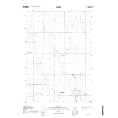
2017 Map of Howard
USGS Topo · Published 2017About this map
Howard and the smaller settlement of Vilas occupy the southern reaches of this Miner County landscape, where the flat agricultural plains begin to rise toward the Coteau des Prairies. This plateau region is characterized by a high concentration of small wetlands and potholes, contrasting with the more structured grid of rural roads like 433rd Ave and 230th St. The W Fork Vermillion River meanders through the eastern portion of the quadrangle, serving as a primary drainage for the surrounding farmland. In Howard, the local street plan includes S Main St and E Howard Ave, while several historical burial grounds including Saint John's Cem, Saint Joseph's Cem, and Graceland Cem are clustered on the town's periphery. To the west, Vilas remains a distinct rail-side community near the intersection of Vilas St and the IOOF Cem.
Find a feature on this map
41 named features on this map. Tap any name to fly to it.
Don’t see what you’re looking for? This feature index may not catch every label — zoom into the map to look around manually.
Map Details
Editions of this 2017 Howard Map
This is the sole edition of this map. No revisions or reprints were ever made.
Other maps of this area

1899 · Alexandria
USGS Topo · 1:125,000

1899 · De Smet
USGS Topo · 1:125,000

1953 · Watertown
USGS Topo · 1:250,000

1955 · Sioux Falls
USGS Topo · 1:250,000

1958 · Sioux Falls
USGS Topo · 1:250,000

1958 · Watertown
USGS Topo · 1:250,000

1968 · Oldham SW
USGS Topo · 1:24,000

1968 · Oldham NW
USGS Topo · 1:24,000

1971 · Howard NE
USGS Topo · 1:24,000

1971 · Howard
USGS Topo · 1:24,000