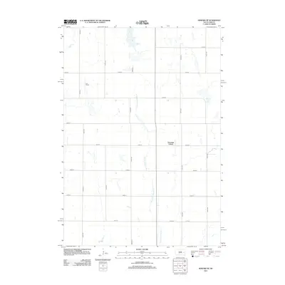
2012 Map of Howard NE
USGS Topo · Published 2012About this map
The agricultural landscape of Miner County is defined by its strict section-line grid and the winding course of the W Fork Vermillion River. This eastern South Dakota prairie region features the communal settlement of the Cloverleaf Colony, situated near the intersection of 221st St and 434th Ave. The terrain is characterized by numerous small prairie potholes and seasonal wetlands typical of the glaciated plains, which break the geometric regularity of the farm fields. Aerial access to this rural area is provided by Lee Airport, located in the northwest portion of the sheet. The map documents the persistent rural character of the region, where a network of gravel roads such as 430th Ave and 435th Ave connect isolated farmsteads and agricultural operations across the expanse between the river and the township boundaries.
Find a feature on this map
16 named features on this map. Tap any name to fly to it.
Don’t see what you’re looking for? This feature index may not catch every label — zoom into the map to look around manually.
Map Details
Editions of this 2012 Howard NE Map
This is the sole edition of this map. No revisions or reprints were ever made.
Other maps of this area

1899 · De Smet
USGS Topo · 1:125,000

1953 · Watertown
USGS Topo · 1:250,000

1958 · Watertown
USGS Topo · 1:250,000

1968 · Oldham SW
USGS Topo · 1:24,000

1968 · Lake Preston West
USGS Topo · 1:24,000

1968 · Oldham NW
USGS Topo · 1:24,000

1971 · Howard NE
USGS Topo · 1:24,000

1971 · De Smet SE
USGS Topo · 1:24,000

1971 · Howard
USGS Topo · 1:24,000
1971 · Carthage
USGS Topo · 1:24,000