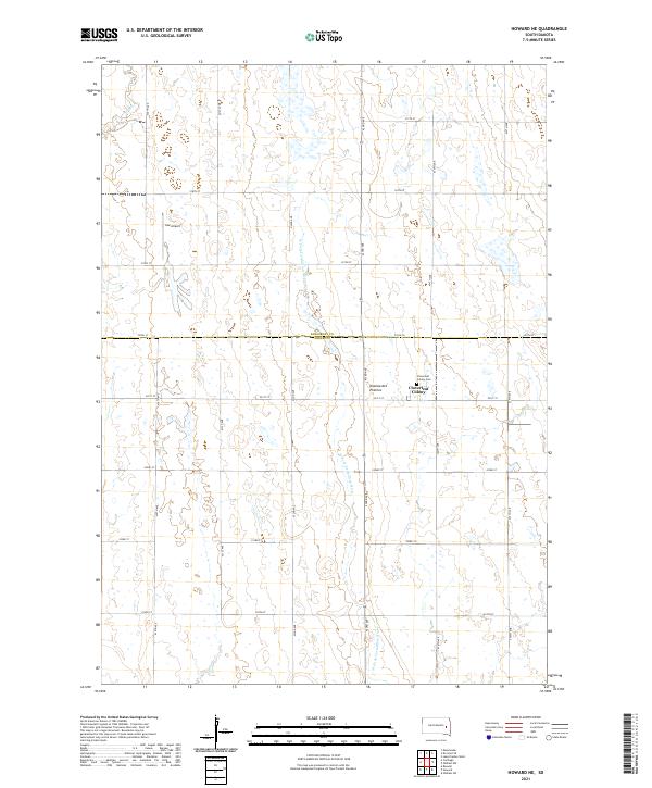
2021 Map of Howard NE
USGS Topo · Published 2021About this map
Coteau des Prairies, a vast glacial upland, defines the topography of this eastern South Dakota landscape. The map is centered on the border of Kingsbury and Miner counties, showing a region shaped by agricultural geometry and subtle watercourses. The W Fork Vermillion River meanders southward through the center of the sheet, while Rock Cr cuts across the northwest corner. This area is characterized by the Cloverleaf Colony, a distinctive communal settlement accompanied by the Cloverleaf Colony Cem. Aviation history is represented by Lee Airport, located in the western portion of the quadrangle. The grid of section lines and rural roads, including 433rd Ave and 220th St, provides a clear view of the land division and transportation network established in this part of the state.
Find a feature on this map
27 named features on this map. Tap any name to fly to it.
Don’t see what you’re looking for? This feature index may not catch every label — zoom into the map to look around manually.
Map Details
Editions of this 2021 Howard NE Map
This is the sole edition of this map. No revisions or reprints were ever made.
Other maps of this area

1899 · De Smet
USGS Topo · 1:125,000

1953 · Watertown
USGS Topo · 1:250,000

1958 · Watertown
USGS Topo · 1:250,000

1968 · Oldham SW
USGS Topo · 1:24,000

1968 · Lake Preston West
USGS Topo · 1:24,000

1968 · Oldham NW
USGS Topo · 1:24,000

1971 · Howard NE
USGS Topo · 1:24,000

1971 · De Smet SE
USGS Topo · 1:24,000

1971 · Howard
USGS Topo · 1:24,000
1971 · Carthage
USGS Topo · 1:24,000