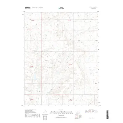
2018 Map of Howard NW
USGS Topo · Published 2018About this map
Osage Cuestas dominate this landscape in southeastern Kansas, where the rolling limestone and shale ridges shape the path of local waterways. The Caney River and its major tributary, the E Fork Caney River, wind through the terrain, joined by smaller streams like Mound Br and Clear Cr. This rural area in Elk County maintains a strong connection to its physical environment and early settlement history, evidenced by the Clear Cut Cem situated in the northern reaches of the quadrangle. The naming conventions of local thoroughfares, such as Limestone Rd, Grain Rd, and Oil Fld Lease Rd, reflect the region's enduring reliance on agriculture and natural resource extraction. The map provides a clear look at how section lines and property divisions have persisted since the late 19th century.
Find a feature on this map
23 named features on this map. Tap any name to fly to it.
Don’t see what you’re looking for? This feature index may not catch every label — zoom into the map to look around manually.
Map Details
Editions of this 2018 Howard NW Map
This is the sole edition of this map. No revisions or reprints were ever made.
Other maps of this area

1885 · Eureka
USGS Topo · 1:125,000

1885 · Sedan
USGS Topo · 1:125,000

1888 · Eureka
USGS Topo · 1:125,000

1888 · Eldorado
USGS Topo · 1:125,000

1889 · Burden
USGS Topo · 1:125,000

1889 · Sedan
USGS Topo · 1:125,000

1894 · Eureka
USGS Topo · 1:125,000

1955 · Wichita
USGS Topo · 1:250,000

1958 · Wichita
USGS Topo · 1:250,000

1962 · Moline
USGS Topo · 1:24,000