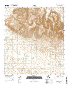
2015 Map of Howard Pass B-5 SE
USGS Topo · Published 2015About this map
Noatak National Preserve encompasses much of this arctic landscape, where the high elevation of Siniktanneyak Mtn dominates the eastern interior. The terrain is defined by a complex network of glacial and alluvial water systems, including the headwaters of Tupichalik Cr which meanders through the southern flats. In the northwest, the prominent Desperation Lake sits near the edge of the survey area, feeding into the drainage of Uivaksak Cr. This 2015 U.S. Geological Survey record captures the drainage patterns and topographic relief of the North Slope's interior during the early 21st century, illustrating the intersection of the national preserve with various township and range boundaries including t12s r28w and t34n r2e.
Find a feature on this map
11 named features on this map. Tap any name to fly to it.
Don’t see what you’re looking for? This feature index may not catch every label — zoom into the map to look around manually.
Map Details
Editions of this 2015 Howard Pass B-5 SE Map
This is the sole edition of this map. No revisions or reprints were ever made.
Other maps of this area

1951 · Howard Pass
USGS Topo · 1:250,000

1956 · Howard Pass
USGS Topo · 1:250,000

1984 · Howard Pass B-4
USGS Topo · 1:63,360
1984 · Howard Pass B-5
USGS Topo · 1:63,360
1990 · Howard Pass A-4
USGS Topo · 1:63,360
1990 · Howard Pass A-5
USGS Topo · 1:63,360
2015 · Howard Pass B-5 SW
USGS Topo · 1:25,000
2015 · Howard Pass A-4 NW
USGS Topo · 1:25,000
2015 · Howard Pass B-5 NW
USGS Topo · 1:25,000
2015 · Howard Pass A-5 NW
USGS Topo · 1:25,000