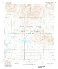
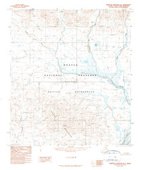
1984 Map of Howard Pass B-5
USGS Topo · Published 1984About this map
Desperation Lake sits at the heart of this North Slope landscape, a significant water body in a region defined by complex aquatic and topographic boundaries. The terrain transitions from the Avingyak Hills in the south toward the prominent heights of Siniktanneyak Mountain to the east. This 1984 edition illustrates the sophisticated administrative layering of the Alaskan Arctic, showing where the Noatak National Preserve and the Uivaksak Wilderness meet the National Petroleum Reserve in Alaska.
Find a feature on this map
23 named features on this map. Tap any name to fly to it.
Don’t see what you’re looking for? This feature index may not catch every label — zoom into the map to look around manually.
Map Details
Editions of this 1984 Howard Pass B-5 Map
This is the sole edition of this map. No revisions or reprints were ever made.
Other maps of this area

1951 · Howard Pass
USGS Topo · 1:250,000

1951 · Misheguk Mountain
USGS Topo · 1:250,000

1956 · Howard Pass
USGS Topo · 1:250,000

1956 · Misheguk Mountain
USGS Topo · 1:250,000
1984 · Misheguk Mountain C-1
USGS Topo · 1:63,360
1984 · Howard Pass C-5
USGS Topo · 1:63,360

1984 · Howard Pass B-4
USGS Topo · 1:63,360

1984 · Howard Pass C-4
USGS Topo · 1:63,360
1990 · Howard Pass A-4
USGS Topo · 1:63,360
1990 · Misheguk Mountain B-1
USGS Topo · 1:63,360