
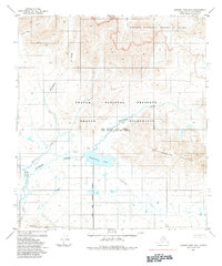
1984 Map of Howard Pass C-4
USGS Topo · Published 1984About this map
The National Petroleum Reserve in Alaska dominates this 1980s landscape, a vast federal tract of the North Slope defined by its complex hydrologic systems. The Kuna River winds prominently through the central and southern portions of the sheet, joined by a network of tributaries including Story Creek, Bushy Creek, and Safari Creek. These waterways drain a terrain marked by distinctive geological formations such as The Cockscomb and the high elevations of Swayback Mountain. In the northern reaches, Swayback Creek feeds into the concentrated cluster of the Swayback Lakes, while Anuk Creek flows across the northern border. This survey provides a detailed view of the remote drainage patterns and named landmarks within the reserve during a period of significant geological interest in the Arctic.
Find a feature on this map
12 named features on this map. Tap any name to fly to it.
Don’t see what you’re looking for? This feature index may not catch every label — zoom into the map to look around manually.
Map Details
Editions of this 1984 Howard Pass C-4 Map
This is the sole edition of this map. No revisions or reprints were ever made.
Other maps of this area

1951 · Howard Pass
USGS Topo · 1:250,000

1956 · Howard Pass
USGS Topo · 1:250,000
1984 · Howard Pass D-4
USGS Topo · 1:63,360
1984 · Howard Pass D-5
USGS Topo · 1:63,360
1984 · Howard Pass D-3
USGS Topo · 1:63,360
1984 · Howard Pass C-5
USGS Topo · 1:63,360

1984 · Howard Pass B-4
USGS Topo · 1:63,360

1984 · Howard Pass B-3
USGS Topo · 1:63,360
1984 · Howard Pass B-5
USGS Topo · 1:63,360

1984 · Howard Pass C-3
USGS Topo · 1:63,360