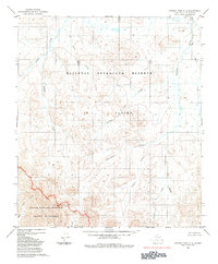
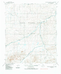
1984 Map of Howard Pass C-5
USGS Topo · Published 1984About this map
The National Petroleum Reserve in Alaska dominates this 1984 survey, which documents a wilderness landscape of the North Slope defined by its complex drainage systems. The northern portion is characterized by the Rolling Hills and the meandering Kiligwa River, which flows alongside numerous tributaries such as Jubilee Creek and Recon Creek. This region illustrates the vast, uninhabited terrain before the full establishment of modern industrial infrastructure, focusing instead on the natural hydrology and land reservations. To the south, the boundary of the Noatak National Preserve and the Noatak Wilderness marks a transition into protected lands, with watercourses like Stone Creek and Twistem Creek carving through the elevation. The absence of roads or trails emphasizes the region's character as a remote wilderness area during the late twentieth century.
Find a feature on this map
14 named features on this map. Tap any name to fly to it.
Don’t see what you’re looking for? This feature index may not catch every label — zoom into the map to look around manually.
Map Details
Editions of this 1984 Howard Pass C-5 Map
This is the sole edition of this map. No revisions or reprints were ever made.
Other maps of this area

1951 · Howard Pass
USGS Topo · 1:250,000

1951 · Misheguk Mountain
USGS Topo · 1:250,000

1956 · Howard Pass
USGS Topo · 1:250,000

1956 · Misheguk Mountain
USGS Topo · 1:250,000
1984 · Misheguk Mountain C-1
USGS Topo · 1:63,360
1984 · Howard Pass D-4
USGS Topo · 1:63,360
1984 · Howard Pass D-5
USGS Topo · 1:63,360
1984 · Misheguk Mountain D-1
USGS Topo · 1:63,360

1984 · Howard Pass B-4
USGS Topo · 1:63,360

1984 · Howard Pass C-4
USGS Topo · 1:63,360