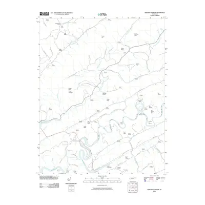
2010 Map of Howard Quarter
USGS Topo · Published 2010About this map
The Clinch River snakes through the center of this Claiborne County landscape, creating sharp meanders like Posey Bend and Lee Bend. This 2010 survey illustrates a region defined by its narrow valleys and prominent ridgelines, including the Butt of Newmans Ridge and Brushy Ridge. The settlement pattern follows the drainages of Big Sycamore Creek and Indian Creek, where numerous family cemeteries point to deep roots in the area. Genealogists will find a high density of burial sites such as Howardton Cemetery, Pearson Cemetery, and Spradling Cemetery scattered throughout the hollows.
Find a feature on this map
103 named features on this map. Tap any name to fly to it.
Don’t see what you’re looking for? This feature index may not catch every label — zoom into the map to look around manually.
Map Details
Editions of this 2010 Howard Quarter Map
This is the sole edition of this map. No revisions or reprints were ever made.
Other maps of this area

1883 · Morristown
USGS Topo · 1:125,000

1886 · Cumberland Gap
USGS Topo · 1:125,000

1887 · Jonesville
USGS Topo · 1:125,000

1888 · Cumberland Gap
USGS Topo · 1:125,000

1891 · Cumberland Gap
USGS Topo · 1:125,000

1891 · Jonesville
USGS Topo · 1:125,000

1893 · Morristown
USGS Topo · 1:125,000

1895 · Morristown
USGS Topo · 1:125,000

1897 · Maynardville
USGS Topo · 1:125,000

1900 · Maynardville
USGS Topo · 1:125,000