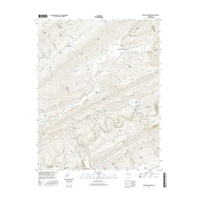
2016 Map of Howard Quarter
USGS Topo · Published 2016About this map
Clinch River topography defines this part of Claiborne and Hancock counties, where the water cuts sharp bends around River Ridge and War Ridge. The settlement at Howard Quarter serves as a central point in a landscape marked by long, parallel ridges like Newman Ridge and Wallen Ridge. Local history is deeply etched into the hillsides through a high density of family burial grounds, including the Spradling Cem, Mallicoat Cem, and Howardton Cem. The transition from the river to the backed-up waters of Norris Lake is evident near the Evans Ferry Bridge, while Numerous small gaps and hollows, such as Fugate Gap and Snake Hollow, provide the primary routes for local roads. This area showcases the classic ridge-and-valley settlement pattern of East Tennessee, where narrow valleys like Caney Valley were the focus of agricultural and domestic life.
Find a feature on this map
124 named features on this map. Tap any name to fly to it.
Don’t see what you’re looking for? This feature index may not catch every label — zoom into the map to look around manually.
Map Details
Editions of this 2016 Howard Quarter Map
This is the sole edition of this map. No revisions or reprints were ever made.
Other maps of this area

1883 · Morristown
USGS Topo · 1:125,000

1886 · Cumberland Gap
USGS Topo · 1:125,000

1887 · Jonesville
USGS Topo · 1:125,000

1888 · Cumberland Gap
USGS Topo · 1:125,000

1891 · Cumberland Gap
USGS Topo · 1:125,000

1891 · Jonesville
USGS Topo · 1:125,000

1893 · Morristown
USGS Topo · 1:125,000

1895 · Morristown
USGS Topo · 1:125,000

1897 · Maynardville
USGS Topo · 1:125,000

1900 · Maynardville
USGS Topo · 1:125,000