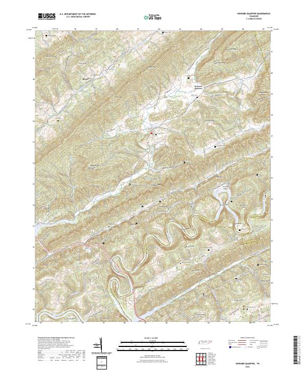
2022 Map of Howard Quarter
USGS Topo · Published 2022About this map
Howard Quarter sits at a crossroads of Appalachian geography where the boundaries of Claiborne, Grainger, and Hancock counties converge. This 2022 survey reveals a landscape defined by parallel ridges and fertile valleys, most notably Caney Valley and the Indian Creek Valley. The intricate network of family cemeteries, including Lynch Cem, Pearson Cem, and Barnard Cem, indicates deep-rooted ancestral settlements throughout the hollows. To the north, Newman Ridge and the Butt of Newmans Ridge loom over the terrain, while the Clinch River carves a winding path through Condry Bend at the southwestern corner. The map documents the persistence of small communities like Ritchie and the complex drainage of Big Sycamore Creek, illustrating how local roads like Upper Caney Valley Rd and Lower Caney Valley Rd still follow the natural contours of the valley floors.
Find a feature on this map
123 named features on this map. Tap any name to fly to it.
Don’t see what you’re looking for? This feature index may not catch every label — zoom into the map to look around manually.
Map Details
Editions of this 2022 Howard Quarter Map
This is the sole edition of this map. No revisions or reprints were ever made.
Other maps of this area

1883 · Morristown
USGS Topo · 1:125,000

1886 · Cumberland Gap
USGS Topo · 1:125,000

1887 · Jonesville
USGS Topo · 1:125,000

1888 · Cumberland Gap
USGS Topo · 1:125,000

1891 · Cumberland Gap
USGS Topo · 1:125,000

1891 · Jonesville
USGS Topo · 1:125,000

1893 · Morristown
USGS Topo · 1:125,000

1895 · Morristown
USGS Topo · 1:125,000

1897 · Maynardville
USGS Topo · 1:125,000

1900 · Maynardville
USGS Topo · 1:125,000