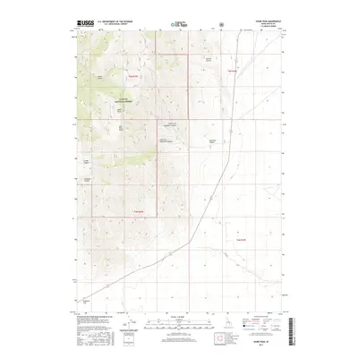
2017 Map of Howe Peak
USGS Topo · Published 2017About this map
Howe Peak stands as a prominent high point within the southern reach of the Lost River Range, overlooking a complex system of drainage basins in Butte County. Part of the Challis National Forest, the terrain is defined by steep, label-dense canyons including Wood Canyon, Sixmile Canyon, and Combe Canyon that cut through the high ridges. This 2017 survey reveals the transition from these mountain heights down to the broad, flat expanse of Deadman Flat. The presence of the Stage Rd crossing the southeastern section suggests historical transit routes through this portion of Idaho, connecting the mountain foothills with the more open desert landscape to the south. The mapping of the Right Fork Eightmile Canyon and Left Fork Eightmile Canyon provides specific detail for those tracing the precise watercourses and geological formations of the range.
Find a feature on this map
16 named features on this map. Tap any name to fly to it.
Don’t see what you’re looking for? This feature index may not catch every label — zoom into the map to look around manually.
Map Details
Editions of this 2017 Howe Peak Map
This is the sole edition of this map. No revisions or reprints were ever made.
Other maps of this area

1955 · Idaho Falls
USGS Topo · 1:250,000

1958 · Idaho Falls
USGS Topo · 1:250,000

1969 · Arco Pass
USGS Topo · 1:24,000

1969 · Little Lost River Sinks
USGS Topo · 1:24,000

1969 · Howe
USGS Topo · 1:24,000

1972 · Arco Hills SE
USGS Topo · 1:24,000

1972 · Howe Peak
USGS Topo · 1:24,000

1972 · Butte City
USGS Topo · 1:24,000

1972 · Arco Hills
USGS Topo · 1:24,000

1973 · Circular Butte 3 SW
USGS Topo · 1:24,000