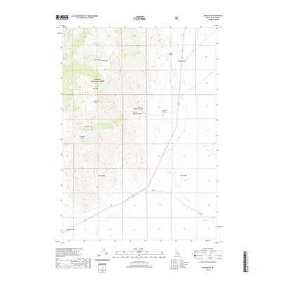
2020 Map of Howe Peak
USGS Topo · Published 2020About this map
Howe Peak rises as the central landmark of this mountain landscape within the Challis National Forest. Situated in the eastern reaches of the Lost River Range, the terrain is defined by a series of deep drainage systems including Wood Canyon, Sixmile Canyon, and Eightmile Canyon. The map reveals the dramatic transition from the high peaks down to Deadman Flat, reflecting the stark topography of Butte County. Human imprint is sparse, primarily concentrated along the lower elevations where Stage Rd traverses the sagebrush plains. This survey captures the remote character of the interior Idaho wilderness, where the naming of places like Deadman Canyon and Combe Canyon points to the early surveying and ranching history of the region.
Find a feature on this map
16 named features on this map. Tap any name to fly to it.
Don’t see what you’re looking for? This feature index may not catch every label — zoom into the map to look around manually.
Map Details
Editions of this 2020 Howe Peak Map
This is the sole edition of this map. No revisions or reprints were ever made.
Other maps of this area

1955 · Idaho Falls
USGS Topo · 1:250,000

1958 · Idaho Falls
USGS Topo · 1:250,000

1969 · Arco Pass
USGS Topo · 1:24,000

1969 · Little Lost River Sinks
USGS Topo · 1:24,000

1969 · Howe
USGS Topo · 1:24,000

1972 · Arco Hills SE
USGS Topo · 1:24,000

1972 · Howe Peak
USGS Topo · 1:24,000

1972 · Butte City
USGS Topo · 1:24,000

1972 · Arco Hills
USGS Topo · 1:24,000

1973 · Circular Butte 3 SW
USGS Topo · 1:24,000