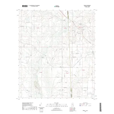
2018 Map of Howell
USGS Topo · Published 2018About this map
The Escatawpa River defines the central geography of this borderland between George County, Mississippi, and Mobile County, Alabama. Small rural settlements like Latonia, Moffet, and Howell are connected by a network of timber and farm roads, including Agricola Latonia Rd and Howell Tanner Chapel Rd. The landscape is characterized by numerous low-lying wetland features such as Juniper Bay and Deer Bay, which separate the higher pine-timbered ground. Local family names are preserved throughout the survey in features like Howell Bridge and the numerous family burial grounds scattered across the terrain. Genealogists will find significant value in the distribution of these small cemeteries, including Finch Cem, Moffetville Cem, and Midway Cem, which reflect the generations of families who established these remote rural communities.
Find a feature on this map
93 named features on this map. Tap any name to fly to it.
Don’t see what you’re looking for? This feature index may not catch every label — zoom into the map to look around manually.
Map Details
Editions of this 2018 Howell Map
This is the sole edition of this map. No revisions or reprints were ever made.
Other maps of this area

1941 · Hurley
USGS Topo · 1:62,500

1941 · Vancleave
USGS Topo · 1:62,500

1941 · Lucedale
USGS Topo · 1:62,500

1942 · Wilmer
USGS Topo · 1:62,500

1943 · Lucedale
USGS Topo · 1:62,500

1943 · Hurley
USGS Topo · 1:62,500

1943 · Vancleave
USGS Topo · 1:62,500

1944 · Wilmer
USGS Topo · 1:62,500

1944 · Vancleave
USGS Topo · 1:62,500

1953 · Mobile
USGS Topo · 1:250,000