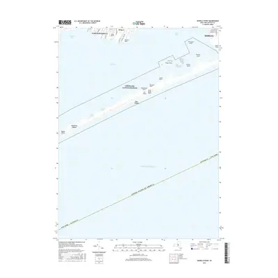
2016 Map of Howells Point
USGS Topo · Published 2016About this map
Fire Island National Seashore dominates the central portion of this coastal survey, preserving the narrow barrier beach that separates the Atlantic Ocean from the protected waters of the Great South Bay. Along the northern shore of the bay, the residential patterns of East Patchogue, Bellport, and Shirley are clearly defined by local roads like S Howells Point Rd and Otis Rd. The map illustrates the complex chain of small islands within Bellport Bay, including John Boyle Island, Hospital Island, and Ridge Island. This 2016 record shows the environmental contrast between the developed mainland and the windswept stretches of Fire Island, where Davis Park and the Bayberry Dunes sit isolated on the shifting sands. The geography highlights the critical role of these barrier landforms in sheltering the inland creeks and coves, such as Howells Creek and Robinson Cove, from the open sea.
Find a feature on this map
37 named features on this map. Tap any name to fly to it.
Don’t see what you’re looking for? This feature index may not catch every label — zoom into the map to look around manually.
Map Details
Editions of this 2016 Howells Point Map
This is the sole edition of this map. No revisions or reprints were ever made.
Other maps of this area

1902 · Setauket
USGS Topo · 1:62,500

1902 · Fire Island
USGS Topo · 1:62,500

1903 · Fire Island
USGS Topo · 1:62,500

1904 · Setauket
USGS Topo · 1:62,500

1904 · Islip
USGS Topo · 1:125,000

1904 · Moriches
USGS Topo · 1:62,500

1919 · Setauket
USGS Topo · 1:62,500

1942 · Islip
USGS Topo · 1:125,000

1947 · Bellport
USGS Topo · 1:24,000

1947 · Howells Point
USGS Topo · 1:24,000