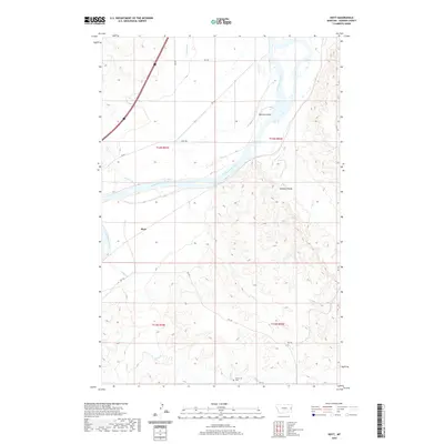
2020 Map of Hoyt
USGS Topo · Published 2020About this map
The Yellowstone River anchors this Dawson County landscape, its course through the high plains defining the local geography with features like Monroe Island and the nearby Smokey Coulee. The small settlement of Hoyt is positioned just south of the river, surrounded by a complex network of seasonal drainage creeks including Clear Cr, Monroe Cr, and Cedar Cr. Agricultural development is evident in the presence of the Main Canal, which draws from the river to support irrigation in this semi-arid region. In the southern portion of the quadrangle, the Glueckstal Cem stands as a significant genealogical landmark, connected to the wider area by rural routes such as RD 130 and RD 121. The topography transitions from river bottomlands to the dissected breaks of the Sand Cr and Cabin Cr drainages.
Find a feature on this map
22 named features on this map. Tap any name to fly to it.
Don’t see what you’re looking for? This feature index may not catch every label — zoom into the map to look around manually.
Map Details
Editions of this 2020 Hoyt Map
This is the sole edition of this map. No revisions or reprints were ever made.
Other maps of this area

1909 · Glendive
USGS Topo · 1:250,000

1953 · Miles City
USGS Topo · 1:250,000

1954 · Glendive
USGS Topo · 1:250,000

1957 · Miles City
USGS Topo · 1:250,000

1957 · Glendive
USGS Topo · 1:250,000

1958 · Miles City
USGS Topo · 1:250,000

1958 · Glendive
USGS Topo · 1:250,000

1966 · Marsh SW
USGS Topo · 1:24,000

1967 · Marsh
USGS Topo · 1:24,000

1967 · Hoyt
USGS Topo · 1:24,000