
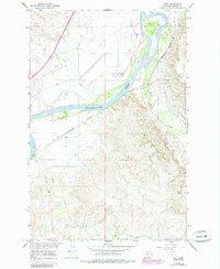
1967 Map of Hoyt
USGS Topo · Published 1970About this map
The Yellowstone River cuts a wide, braided path through this portion of Dawson County, creating a complex landscape of shifting sandbars and river islands. Along the southern bank, the Northern Pacific railroad tracks follow the river's curve, passing through the small siding of Hoyt. This area represents a crossroads of frontier history and modern industry, where the historic Lewis and Clark Trail corridor meets the mid-century infrastructure of the Glendive Oil Field.
Find a feature on this map
15 named features on this map. Tap any name to fly to it.
Don’t see what you’re looking for? This feature index may not catch every label — zoom into the map to look around manually.
Map Details
Editions of this 1967 Hoyt Map
2 editions found
Other maps of this area

1909 · Glendive
USGS Topo · 1:250,000

1953 · Miles City
USGS Topo · 1:250,000

1954 · Glendive
USGS Topo · 1:250,000

1957 · Miles City
USGS Topo · 1:250,000

1957 · Glendive
USGS Topo · 1:250,000

1958 · Miles City
USGS Topo · 1:250,000

1958 · Glendive
USGS Topo · 1:250,000

1966 · Marsh SW
USGS Topo · 1:24,000

1967 · Marsh
USGS Topo · 1:24,000
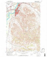
1967 · Glendive
USGS Topo · 1:24,000