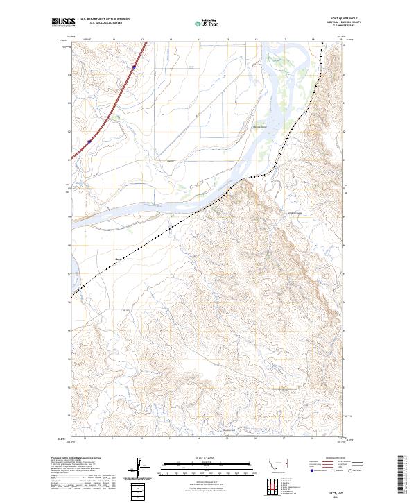
2024 Map of Hoyt
USGS Topo · Published 2024About this map
The Yellowstone River cuts through the heart of this Dawson County landscape, creating a distinct boundary between the irrigated plains and the broken upland coulees. The river's influence is evident in the presence of Monroe Island and the engineering of the Main Canal, which signals the importance of water management for local agriculture. Small settlements like Hoyt represent the rural hubs that once anchored these prairie communities during the height of the homesteading era.
Find a feature on this map
23 named features on this map. Tap any name to fly to it.
Don’t see what you’re looking for? This feature index may not catch every label — zoom into the map to look around manually.
Map Details
Editions of this 2024 Hoyt Map
This is the sole edition of this map. No revisions or reprints were ever made.
Other maps of this area

1909 · Glendive
USGS Topo · 1:250,000

1953 · Miles City
USGS Topo · 1:250,000

1954 · Glendive
USGS Topo · 1:250,000

1957 · Miles City
USGS Topo · 1:250,000

1957 · Glendive
USGS Topo · 1:250,000

1958 · Miles City
USGS Topo · 1:250,000

1958 · Glendive
USGS Topo · 1:250,000

1966 · Marsh SW
USGS Topo · 1:24,000

1967 · Marsh
USGS Topo · 1:24,000

1967 · Hoyt
USGS Topo · 1:24,000