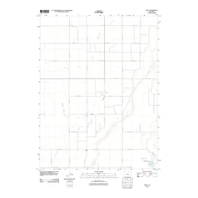
2010 Map of Hoyt
USGS Topo · Published 2010About this map
Hoyt serves as the primary settlement hub in this part of Morgan County, situated within a landscape defined by an extensive network of ephemeral waterways. The drainage patterns of Bijou Creek, Antelope Creek, and Muddy Creek cut through the high plains, while Antelope Flat and Bidwell Hill provide topographic variety. The map documents the localized water management systems of the era, most notably at the Baseline Reservoir and its associated Baseline Dam in the southeastern corner. For those researching local family history, the Hoyt Cemetery remains a critical landmark near the center of the survey. The grid of county roads, from County Road A to County Road I, reflects the structured land division typical of Colorado's eastern agricultural plains at the beginning of the 21st century.
Find a feature on this map
26 named features on this map. Tap any name to fly to it.
Don’t see what you’re looking for? This feature index may not catch every label — zoom into the map to look around manually.
Map Details
Editions of this 2010 Hoyt Map
This is the sole edition of this map. No revisions or reprints were ever made.
Other maps of this area

1950 · Wiggins
USGS Topo · 1:24,000

1950 · Wiggins SW
USGS Topo · 1:24,000

1950 · Hoyt
USGS Topo · 1:24,000

1951 · Hoyt
USGS Topo · 1:24,000

1951 · Leader NW
USGS Topo · 1:24,000

1951 · Omar
USGS Topo · 1:24,000

1951 · Leader
USGS Topo · 1:24,000

1953 · Denver
USGS Topo · 1:250,000

1954 · Limon
USGS Topo · 1:250,000

1954 · Sterling
USGS Topo · 1:250,000