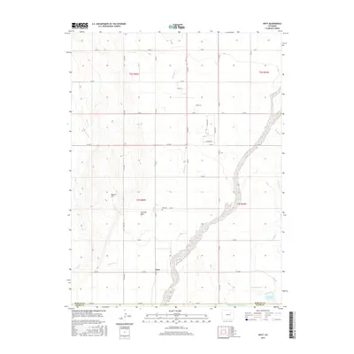
2016 Map of Hoyt
USGS Topo · Published 2016About this map
The small settlement of Hoyt serves as the focal point for this rural expanse along the Morgan Co Adams Co line. This high plains landscape is defined by its drainage systems, where intermittent watercourses like Antelope Creek, Rock Creek, and Muddy Creek cut through the terrain. The area is largely organized by a grid of county roads, such as Co RD B and Co RD 300, facilitating access to the scattered agricultural holdings and land features like Antelope Flats and Bidwell Hill. Genealogists and local historians will find the Hoyt Cemetery north of the main settlement, a primary landmark for the community's heritage. To the south, the presence of Moore Reservoir Number 4 and Baseline Reservoir indicates the critical role of water management in this arid part of Colorado.
Find a feature on this map
39 named features on this map. Tap any name to fly to it.
Don’t see what you’re looking for? This feature index may not catch every label — zoom into the map to look around manually.
Map Details
Editions of this 2016 Hoyt Map
This is the sole edition of this map. No revisions or reprints were ever made.
Other maps of this area

1950 · Wiggins
USGS Topo · 1:24,000

1950 · Wiggins SW
USGS Topo · 1:24,000

1950 · Hoyt
USGS Topo · 1:24,000

1951 · Hoyt
USGS Topo · 1:24,000

1951 · Leader NW
USGS Topo · 1:24,000

1951 · Omar
USGS Topo · 1:24,000

1951 · Leader
USGS Topo · 1:24,000

1953 · Denver
USGS Topo · 1:250,000

1954 · Limon
USGS Topo · 1:250,000

1954 · Sterling
USGS Topo · 1:250,000