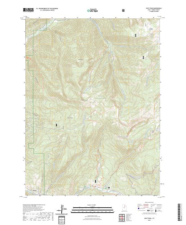
2023 Map of Hoyt Peak
USGS Topo · Published 2023About this map
Samak and the nearby residential area of Sumak Acres sit at the southwestern edge of this mountain study, serving as a gateway to the high-elevation drainage basins of the Wasatch National Forest. The landscape is defined by its complex network of seasonal creeks and steep-walled canyons, including Hoyt Canyon and Seymour Canyon, which feed into major waterways like the South Fork Weber River and Beaver Creek.
Find a feature on this map
49 named features on this map. Tap any name to fly to it.
Don’t see what you’re looking for? This feature index may not catch every label — zoom into the map to look around manually.
Map Details
Editions of this 2023 Hoyt Peak Map
This is the sole edition of this map. No revisions or reprints were ever made.
Other maps of this area

1885 · Salt Lake
USGS Topo · 1:250,000

1900 · Coalville
USGS Topo · 1:125,000

1903 · Coalville
USGS Topo · 1:125,000

1954 · Salt Lake City
USGS Topo · 1:250,000

1958 · Salt Lake City
USGS Topo · 1:250,000

1960 · Salt Lake City
USGS Topo · 1:250,000

1967 · Francis
USGS Topo · 1:24,000

1967 · Kamas
USGS Topo · 1:24,000
1967 · Crandall Canyon
USGS Topo · 1:24,000
1972 · Erickson Basin
USGS Topo · 1:24,000