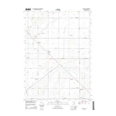
2014 Map of Hoytville
USGS Topo · Published 2014About this map
Hoytville and the surrounding Eaton County countryside are defined by a rhythmic grid of rural highways and the winding paths of the Thornapple River and its tributaries. This agricultural landscape is dotted with small, historic nodes of settlement such as Shaytown, Little Venice, and Gresham. The network of local drains, including the Winchell and Union Drain and Cole-Waight Helms Drain, illustrates the intensive hydrological management required for the region's farming economy. Genealogists will find significant value in the distribution of family and community burial grounds like Welch Cem and Moyer Cem, which are tucked away at rural intersections. Aviation history is represented by Law Field Airport in the southwest, while the diagonal traverse of N Clinton Trl provides a distinct break from the cardinal orientation of roads like W Mt Hope Hwy and Bismark Hwy.
Find a feature on this map
54 named features on this map. Tap any name to fly to it.
Don’t see what you’re looking for? This feature index may not catch every label — zoom into the map to look around manually.
Map Details
Editions of this 2014 Hoytville Map
This is the sole edition of this map. No revisions or reprints were ever made.
Other maps of this area

1916 · Ionia
USGS Topo · 1:62,500

1918 · Ionia
USGS Topo · 1:62,500

1943 · Ionia
USGS Topo · 1:62,500

1945 · Portland
USGS Topo · 1:62,500

1949 · Charlotte
USGS Topo · 1:62,500

1950 · Nashville
USGS Topo · 1:62,500

1951 · Nashville
USGS Topo · 1:62,500

1958 · Grand Rapids
USGS Topo · 1:250,000

1961 · Grand Rapids
USGS Topo · 1:250,000

1962 · Grand Rapids
USGS Topo · 1:250,000