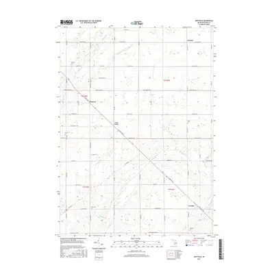
2017 Map of Hoytville
USGS Topo · Published 2017About this map
The rural agricultural landscape of Eaton County is defined by its deep-rooted cemetery sites and small hamlets. Hoytville and Shaytown serve as focal points in a territory carved by the Thornapple River and its various tributaries, including Sebewa Cr and Thompson Cr. The land is predominantly partitioned by a systematic grid of historic roads like W Saginaw Hwy and St Joe Hwy, reflecting the state's established survey patterns. Notable for genealogists are the numerous burial grounds scattered across the townships, such as Sunfield Cem, Welch Cem, and Ames Cem, which often represent the earliest centers of these farming communities. The map also captures the specialized drainage networks like the Winchell and Union Drain and Cole-Wright Helms Drain, essential for managing the low-lying prairie and marshlands characteristic of central Michigan.
Find a feature on this map
58 named features on this map. Tap any name to fly to it.
Don’t see what you’re looking for? This feature index may not catch every label — zoom into the map to look around manually.
Map Details
Editions of this 2017 Hoytville Map
This is the sole edition of this map. No revisions or reprints were ever made.
Other maps of this area

1916 · Ionia
USGS Topo · 1:62,500

1918 · Ionia
USGS Topo · 1:62,500

1943 · Ionia
USGS Topo · 1:62,500

1945 · Portland
USGS Topo · 1:62,500

1949 · Charlotte
USGS Topo · 1:62,500

1950 · Nashville
USGS Topo · 1:62,500

1951 · Nashville
USGS Topo · 1:62,500

1958 · Grand Rapids
USGS Topo · 1:250,000

1961 · Grand Rapids
USGS Topo · 1:250,000

1962 · Grand Rapids
USGS Topo · 1:250,000