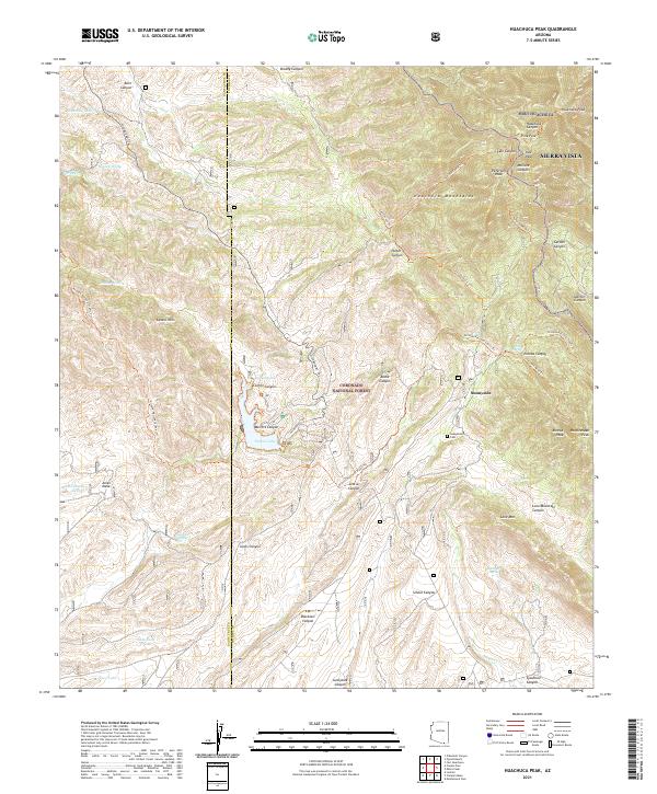
2021 Map of Huachuca Peak
USGS Topo · Published 2021About this map
Sunnyside rests within the high-desert landscape of the Huachuca Mountains, serving as a focal point for this rugged portion of the Coronado National Forest. This modern 2021 survey reveals a complex network of canyons and peaks along the border of Santa Cruz and Cochise counties, dominated by the prominent elevation of Huachuca Peak. The presence of the Sunnyside Cem and the nearby Parker Lake suggests a landscape shaped by both early settlement and modern conservation. To the northeast, the military installation of Fort Huachuca extends into the foothills, while the western edge transitions into the Canelo Hills. Named landmarks like Beckers Folly and various livestock tanks such as Sawtelle Tank and Bill Woods Tank point to the area's history of cattle ranching and persistent water management in an arid environment. A dense system of trails, including the Arizona National Scenic Trl and Eureka Mine Trl, weaves through Scotia Canyon and Merritt Canyon, tracing the paths of miners and explorers.
Find a feature on this map
59 named features on this map. Tap any name to fly to it.
Don’t see what you’re looking for? This feature index may not catch every label — zoom into the map to look around manually.
Map Details
Editions of this 2021 Huachuca Peak Map
This is the sole edition of this map. No revisions or reprints were ever made.
Other maps of this area

1904 · Patagonia
USGS Topo · 1:125,000

1905 · Patagonia
USGS Topo · 1:125,000

1905 · Nogales
USGS Topo · 1:125,000

1914 · Hereford
USGS Topo · 1:125,000

1915 · Benson
USGS Topo · 1:125,000

1922 · Sunnyside
USGS Topo · 1:62,500

1932 · Lochiel
USGS Topo · 1:62,500

1932 · Elgin
USGS Topo · 1:62,500

1938 · Huachuca
USGS Topo · 1:62,500

1938 · Sunnyside
USGS Topo · 1:62,500