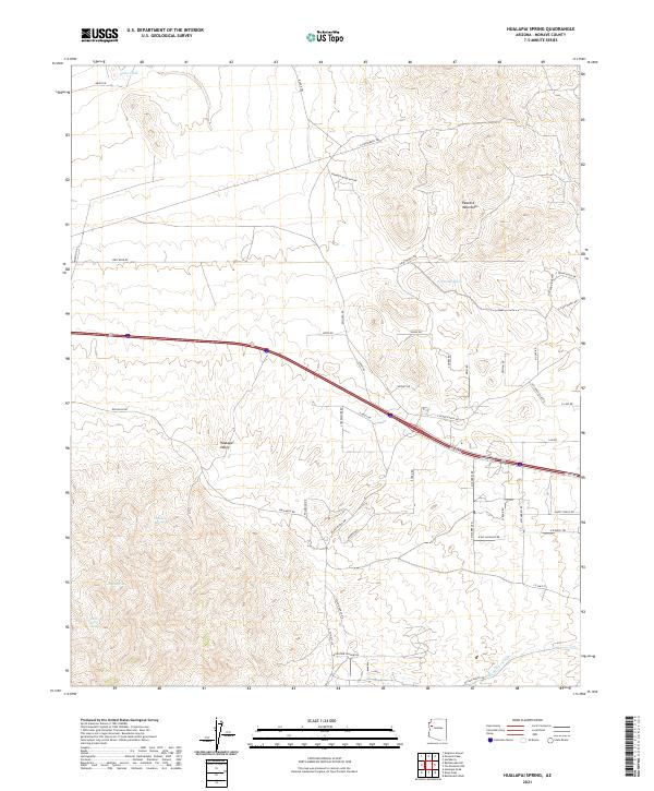
2021 Map of Hualapai Spring
USGS Topo · Published 2021About this map
Hualapai Spring and several other vital water sources define this high-desert landscape in Mohave County. Situated where the Hualapai Valley meets the rising slopes of the Peacock Mountains, the map reveals a network of intermittent drainages like Peacock Wash and McGarrys Wash. This area serves as a significant intersection of geography and modern infrastructure, as the primary corridor of Dubois Rd cuts across the center of the valley floor. To the south, the terrain becomes increasingly complex as the elevation rises, marked by Bunt Spring and the curiously named Lion Kill Spring. The landscape is a mix of wide-open valley floor and the dissected foothills of the Peacocks, where local access roads like DW Ranch Rd and E Blake Ranch Rd wind through the township and range sections.
Find a feature on this map
55 named features on this map. Tap any name to fly to it.
Don’t see what you’re looking for? This feature index may not catch every label — zoom into the map to look around manually.
Map Details
Editions of this 2021 Hualapai Spring Map
This is the sole edition of this map. No revisions or reprints were ever made.
Other maps of this area

1886 · Diamond Creek
USGS Topo · 1:250,000

1892 · Diamond Creek
USGS Topo · 1:250,000

1948 · Williams
USGS Topo · 1:250,000

1954 · Williams
USGS Topo · 1:250,000

1956 · Williams
USGS Topo · 1:250,000

1960 · Williams
USGS Topo · 1:250,000

1961 · Williams
USGS Topo · 1:250,000
1968 · Kingman Airport
USGS Topo · 1:24,000
1968 · Hualapai Peak
USGS Topo · 1:24,000
1968 · Peacock Peak
USGS Topo · 1:24,000