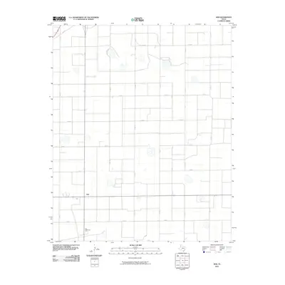
2010 Map of Hub
USGS Topo · Published 2010About this map
The unincorporated community of Hub serves as the focal point of this 2010 survey of the Texas Panhandle. Located in Parmer County, the settlement is characterized by a sprawling grid of rural county roads that facilitate the local agricultural economy. The Hub Community Hall stands as a central social landmark for the area, located just south of the main town intersection. The landscape is defined by the rigid geometry of the High Plains, with a systematic network of thoroughfares such as Fm 2397 and several numbered routes including Co RD 19 and Co RD 20 that segment the vast fields. Dozens of small, seasonal water basins or depressions are scattered throughout the quadrangle, illustrating the natural drainage patterns of this semi-arid region during the first decade of the 21st century.
Find a feature on this map
16 named features on this map. Tap any name to fly to it.
Don’t see what you’re looking for? This feature index may not catch every label — zoom into the map to look around manually.
Map Details
Editions of this 2010 Hub Map
This is the sole edition of this map. No revisions or reprints were ever made.
Other maps of this area

1954 · Clovis
USGS Topo · 1:250,000

1958 · Clovis
USGS Topo · 1:250,000

1963 · Clays Corner
USGS Topo · 1:24,000

1963 · Lazbuddie
USGS Topo · 1:24,000

1963 · Lariat NE
USGS Topo · 1:24,000

1965 · Tam Anne
USGS Topo · 1:24,000

1965 · Parmerton
USGS Topo · 1:24,000

1965 · Hub
USGS Topo · 1:24,000

1965 · Twin Lakes
USGS Topo · 1:24,000

1966 · Friona
USGS Topo · 1:24,000