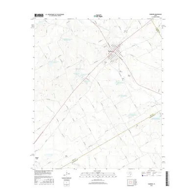
2016 Map of Hubbard
USGS Topo · Published 2016About this map
The town of Hubbard sits at a geographic crossroads in Hill County, where various farm-to-market roads and local routes like FM 2114 and Ranch Rd 936 converge. The landscape is heavily defined by watershed management, evidenced by numerous Soil Conservation Service reservoirs and the clustered Hubbard Lake system. To the southwest, the town of Mount Calm marks the edge of the survey near the Navasota River. Genealogists will find several burial grounds across the terrain, including Fairview Cem, McLain Cem, and Pin Oak Cem, providing a detailed record of local families and settlements. The presence of Ruyle Bridge and the Bar 16 Airport indicates a mix of traditional rural infrastructure and private aviation. The drainage patterns of Turkey Cr and Post Oak Cr illustrate the complex hydrology feeding into the larger river systems of central Texas.
Find a feature on this map
101 named features on this map. Tap any name to fly to it.
Don’t see what you’re looking for? This feature index may not catch every label — zoom into the map to look around manually.
Map Details
Editions of this 2016 Hubbard Map
This is the sole edition of this map. No revisions or reprints were ever made.
Other maps of this area

1920 · Mart
USGS Topo · 1:62,500

1954 · Waco
USGS Topo · 1:250,000

1955 · Waco
USGS Topo · 1:250,000

1956 · Hubbard
USGS Topo · 1:24,000

1956 · Penelope
USGS Topo · 1:24,000

1956 · Axtell
USGS Topo · 1:24,000

1956 · Dawson
USGS Topo · 1:24,000

1957 · Irene
USGS Topo · 1:24,000

1957 · Prairie Hill
USGS Topo · 1:24,000

1957 · Groesbeck
USGS Topo · 1:62,500